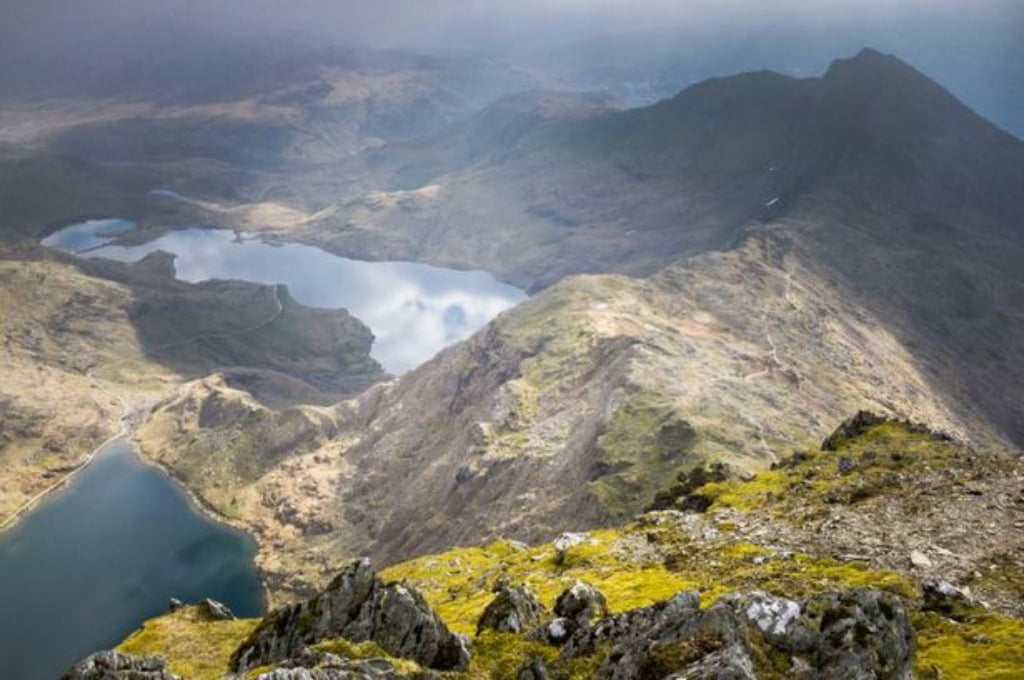
Snowdonia National Park is the largest park in Wales covering over 823 square miles and it’s a short 20-minute drive from the award-winning Imperial Hotel in Llandudno.
Snowdon is at the Park’s heart standing at 1,085m (3,560ft) high and it offers many popular walking routes up to its summit so it is suitable for walkers of all ages and abilities. Routes range from the easy to the very strenuous Crib Goch which is a scramble along a knife-edge ridge so please only attempt this if you are very experienced! These are the popular routes which are in order of difficulty:
- Crib Goch – return trip of 6.2 miles, elevation of 923m (3,082ft)
- The Watkin Path – return trip of 8 miles, elevation of 1,015m (3,330ft)
- Snowdon PYG Track – return trip of 7 miles, elevation of 723m (2,372ft)
- Rhyd Ddu Path – return trip of 8.5 miles, elevation of 895m (2,936ft)
- Miner’s Track – return trip of 8 miles, elevation of 723m (2,372ft)
- Snowdon Ranger Path – return trip of 8 miles, elevation of 936m (3,071ft)
- Llanberis Path – return trip of 9 miles, elevation of 975m (3,199ft)
The views from the summit are spectacular so whichever route you take the effort will, weather permitting, be worth it as you can see as far as the Wicklow Mountains in Ireland and the Isle of Man.
There are many other mountains in North Wales that are just as beautiful and accessible as Snowdon:
Cader Idris, Welsh for the Chair of Idris, is a 893m (2,930ft) high mountain that lies at the southern end of the Snowdonia National Park. Legend has it that Idris was a poet, astronomer and philosopher who used the mountain as his throne and it is believed that huge boulders at the bottom of the mountain are the stones the giant shook out of his shoe! There are a number of paths up to the summit:
- The Minffordd Path, 6.2 miles, elevation of 930m (3,051ft)
- The Pony Path, 5.5 miles, elevation of 750m (2,460ft)
- The Fox’s Path – 5.5 miles, elevation of 710m (2,329ft)
- Llanfihangel Path, 9.9 miles, elevation of 870m (2,854ft)
Glyderau, known as the Glyders is a mountain group which includes five of Wales’ fifteen summits over 914 metres (3,000ft). The Glyderau from Llyn Idwal route is a short walk which covers the two highest mountains – Glyder Fach and Glyder Fawr – and takes you to the much photographed Cantilever, which is an overhanging stone that can take the weight of several people standing on it. This route is accessed from the A5 near Llyn Ogwen taking you across Cwm Idwal, a national nature reserve which is one of the few places where the Snowdon Lilly grows. This walk gives you a good view over to Snowdon as well as Tryfan and the Carneddau.
The Carneddau boasts seven of the fifteen highest peaks in the country, and 19 peaks over 600 metres (1,960ft) in height including Carnedd Llewelyn which is the 3rd highest mountain in Snowdonia. The range also includes a number of lakes such as Llyn Cowlyd, Llyn Eigiau and Llyn Ogwen which is reputed to be the place Sir Bedivere failed to draw King Arthur’s sword Excalibur.
There’s also the Snowdonia Slate Trail, which is an 83 mile circular trail enabling walkers to explore the industrial heritage of the slate villages like Dinorwig, Llanberis, Beddgelert and Ffestiniog. The route starts at Porth Penrhyn, outside Bangor and ends at Bethesda.
